
Kyaing Tong (Shan Stae)
Kyaing Tong is the capital of Eastern Shan Stae in the famous Golden Triangle Region where Myanmar, Thai and Laos territories meet. It can be accessible by flight from either Yagnon or Mandalay or Heho. It lies in the valley between the high misty mountains of the Shan Plateau bordered by the Mekong and Thanlwin Rivers. It is one of settlement of 35 different Shan ethnic groups mostly found - Gon Shan, Ang, Akha, Lisu, Wa and Lahu, Kyaing Tong means "walled City of Tuang". The original city walla and gates can still be seen today.
Kyaing Tong is a pretty town with winding streets that go up and down the small hillocks on which it rests. Lone Tree on top of the Soon Mun Hill at the outskirt of the city stands alone on the hill, Naung Tong Lake lies in the center of the city- a pretty spot to stroll around by it. The market is a good place to hang out in the morning, tribal people in the area come to shop and sell. The wooden monasteries - Wat Zom Khun and Wat in are excellent ones of which architectural style closer to Laotian and Thai temples. The traditional Shan art work by now is only seen at U Mu Ling Ta's lacquer ware shop.
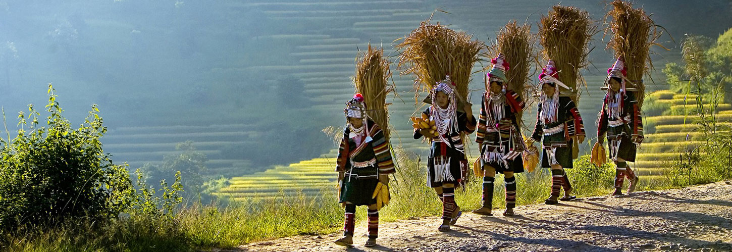
Kyaing Tong has trails and places rich with a diversity of people, old customs and older crafts. The Loi, Akha, Lahu, Lishaw, Palaung and Ang live in sparate villages some distance from each other. Although they do not mingle freely, they have resided with harmony and peace. These ethnic tribes had preserved their ancient customs and traditions as well as their unique and colorful dresses up to now. Most women in the villages embroider the Akha designs on rectangular pieces of black cloth. Eco-tourism activities can be done there such as trekking, bird watching, mountain biking tours. The Lwei Mwe village near Kyaing Tong is a former British hill station during the colonial period and ideal place to visit.
From 1243 A.D, to the last Sawbwa (the cheftain) reigned there were altogether 45 Sawbwas. Although there are many ethnic majorities living in this area having faith in different religions, Buddhism is the main religion of this area.
There are regular flights from Yangon to Kyaing Tong. Tachileik is also a border crossing point through which visitors from Thailand with border pass can come to Myanmar. Two interesting places of Loimwe and Mongla can also be accessible by car from Kyaing Tong.
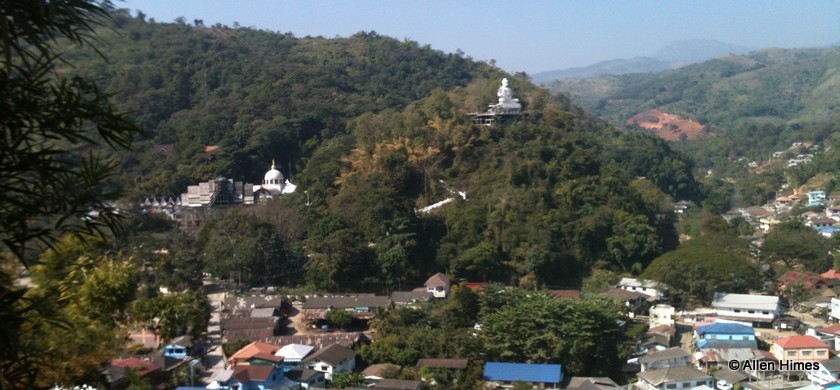
Loimwe, 38 km to the east from Kyaing Tong, was the seat of the British District Commissioner during the colonial period. This hill station features a number of old colonial buildings and a century-old Catholic church. The main attraction is the scenery on the ascent to Loimwe, as you pass through forests, terraced rice fields and past a lake.
Mongla is right on the border with Xishaungbanna is China but on the Myanmar side. China border can be reached from Kyaing Tong by road (2 1/2 hours. Mong La is flourishing town where the border trade, especially the tourist industry is booming. Tourist across the border pour in daily to do shopping, see the highly popular elephant circus and crocodile show or just to relax at pleasant picnic site surrounded by emerald green mountains.
Tachileik (Shan State)
Tahileik, the border town locates at the eastern part of Myanmar, sits directly at the north of Mae Sai, Thailand. The town, once the restricted area for foreigners to visit, is now of the permitted border crossing towns with Thailand for both traders and tourists.
Border trade in that area surges not only with the produce from Myanmar and Thailand but also with goods from China through Myanmar-China border to Thailand and goods from Thailand through Myanmar-Thai border to China. Tachileik is also known as Myanmar's gate way to the Golden Triangle area.
The trading town also serves as gateway to visit Kyaing Tong - a small cozy city surrounded by villages of ethnic tribes and about four hours drive from Tachileik - for tourists crossing MYanmar-Thai border. The border crossing permission for limited number days can can easily be applied at the border check point.
Lashio (Shan State)
Lashio is the largest town as well as capital in northern Shan State at and altitude of 3100 ft, on a low mountain spur overlooking the valley of the Nam Yao river, a tributary of Namtu river. Lashio is the start the famous Burma Road built by the British before the World War II, which intersect with Ledo Road leading into the Yunnan province, China.
The population is made up of mostly Myanmar, Shan and Chinese. Man-Su Pagoda and Pyi Lone Chanther pagodas are of common visit. Central market in the morning is packed with some ethnic gorps. The natural hot spa, nearly five miles away from the city center, on the road to Mu-Se are also worth a visit.
Hsipaw
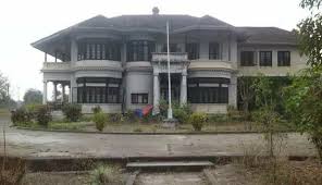
Hsipaw was once the center of a small Shan state, the local capital of a Shan principality of the same name which according to its legendary history goes back to year 58 B.C. Bamar pronounces the name as Thibaw and the last Myanmar king Thibaw (1875-85 AD) got his chieftain - was destroyed by bombing during the last World War, but we were able to visit the modern Sawbwa's residence built during colonial times by Sawbwa Sao Ohn Kya who ruled Hsipaw from 1928 to 1938.
Hsipaw has a local market in the center of the town, with cinemas, small guest houses and restaurants near the bus stands. The Haw (Palace) is at the northern end of the town and the main pagoda, the Maha Myatmuni Phaya is right at the southern end. The roads are parallel to the Namtu or Dokhtawaddy River. We can visit Bawgyo Pagoda, a very Shan-style pagoda from the 14th century, Shan Palace and Mahamyatmuni Paya. Further along the way before we reach Lashio are some Shan villages.
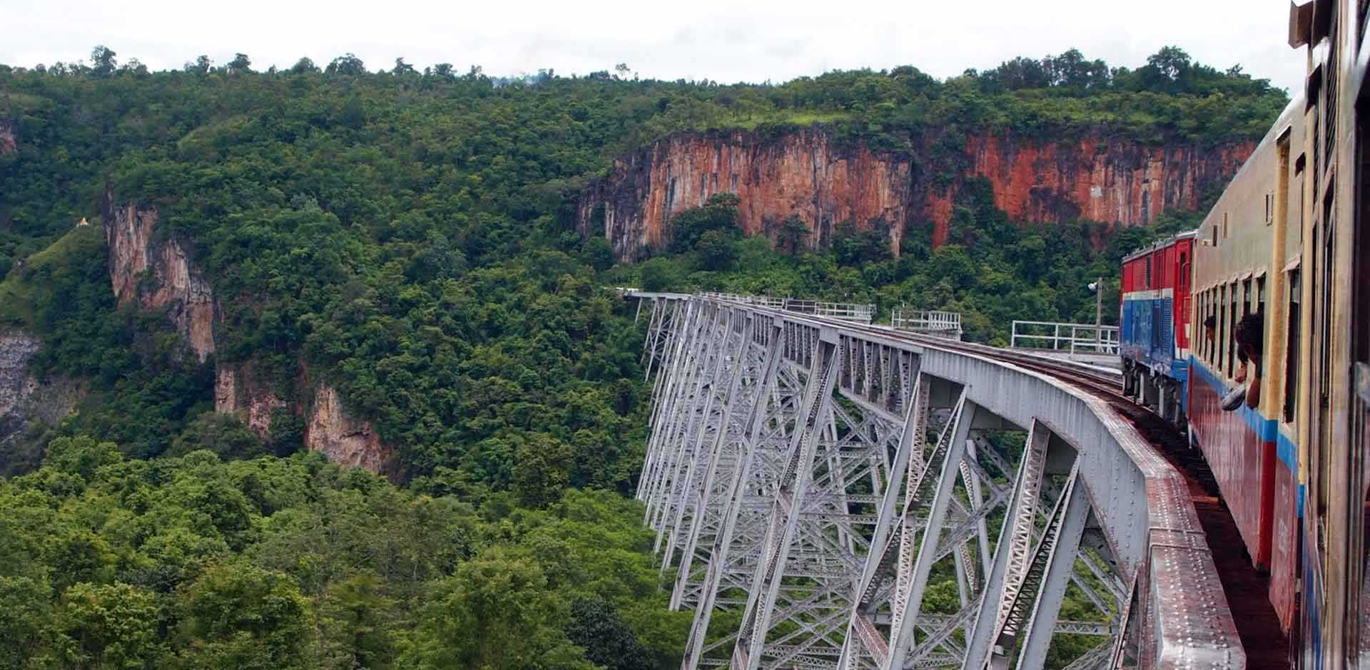
Crossing the Goteik Viaduct - The Highest Railway Bridge in Myanmar
The Goteik Viaduct is the highest railway bridge in Myanmar and you can take a heart-racing ride across it as part of the three-hour train journey from the trekking haven of Hsipaw to the former colonial summer hideaway of Pyin Oo Lwin.
The bridge was constructed in 1899 and was so technical it was revered highly by world standards. 689 meters in length from one end to the other, it's certainly not for those who are faint-hearted - the drop is said to be 102 meters (335 ft) from the track to the ground.
Loikaw
Loikaw is the capital of Kayah State, an area of about 7.290 square kilometers, located at the southern part of Shan State and bordering whit Thailand to the east. In Myanmar literature, the Kayah State is known as Ngwe Taung Pyay (the country with the silver mountain).
Loikaw situates on the elevation of about 1,200 meters and about 113 kilometer south of Kalaw, Shan Sate. Loikaw and surroundings are famous not only for its richness in culture but also for the existence of one of Myanmar's largest hdro-power plants, Lawpita I and II, which have already passsed their golden jubilee.
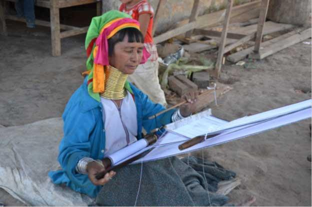
Padaun tribe, one of the most interesting tribes in Myanmar, resides near Loikaw, Padaung women are famous because of the wearing of brass and copper rings around their necks which they believe would make their necks like graceful swans.
The famous and beautiful Moebyae Dam, situated 29 kilometers north of Loikaw, on the Belu creek was constructed on 1971. The dam not onyl serves as a powerful water supply for hydro-power plants but also can irrigate about 20,000 acres of farmlands.
Muse (Shan Sate)
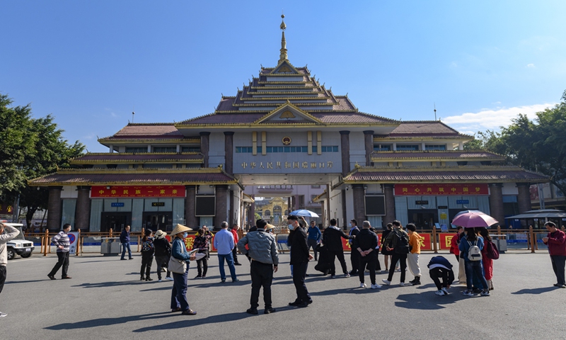
Muse, a small town on the banks of the Shweli River, is the main border gateway between Myanmar and Yunnan Province (China). Located 10 km from Lashio, it is now the busting trading center for China and Myanmar.
The town is also one of the gateways for foreign tourists entering and leaving Myanmar by crossing the border.