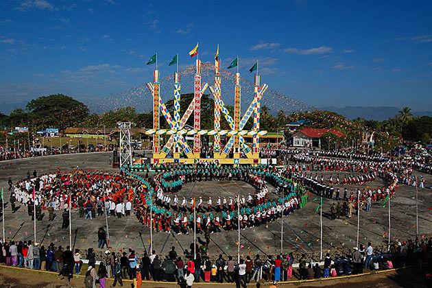
Myitkyina (Kachin State)
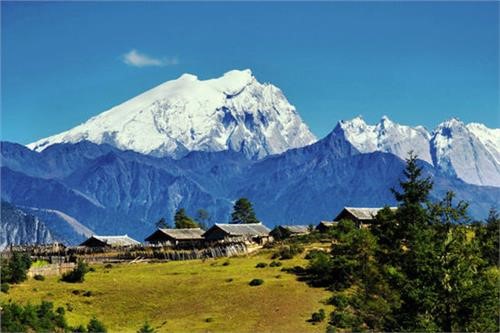
Kachin State is located in the far north of Myanmar. It is home to Myanmar's highest snow-capped mountains, which form the southern tip of the Himalayas, and also Myanmar's largest lake, Indawgyi.
The Kachin Hills are heavily forested highlands in the northeastern part of the country. They are inhabited by the Kachin people, also known as Jing Paw, who are called Singphos on the Assam frontier in India. About 50% of Kachin State is covered with hills and mountains, some reaching up to 5,881 meters above sea level.
Natural Resources
Kachin State is rich in natural resources. It is especially known for its high-quality jade and teak timber. The area also produces gold. Hpa-Kant is the most famous jade mining area in the region.
The land is still covered with undisturbed natural forests. Rare species can be found here, including:
· Black orchids
· White pheasants
· Golden fish (found at the confluence of the Mali and Nmai rivers)
Climate and Weather
Daily temperatures in Kachin State range from 4°C to 36°C, with humidity levels between 60% and 95%. In hill cities like Putao, temperatures can drop as low as -4°C to 18°C, with lower humidity.
The upper part of Kachin State, including the beautiful plateau city of Putao, falls within a temperate climate zone. Annual rainfall ranges from 80 to 200 inches, with more rain falling in mountainous areas.
Population and Major Cities
The estimated population of Kachin State is about 6 million people. Major cities include:
· Bhamo
· Moekang
· Putao
· Moenyin
· Katha
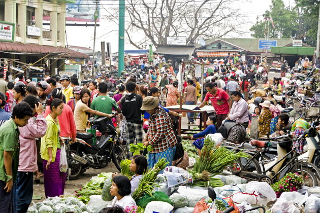
The population is made up of various ethnic groups, including Kachin, Bamar, Shan, Lisu, Chinese, and Indians. They live together peacefully and practice different religions, including Buddhism, Christianity, Islam, and Hinduism. You can find churches, pagodas, and monasteries throughout the state.
According to official statistics:
· 57% are Buddhist
· 36.4% are Christian
Language and Ethnic Groups
The Kachin language is the main language spoken in the state and is written using the Roman alphabet. However, Burmese is the national language.
The Kachin people are made up of six major groups and five other subgroups. The main groups include:
· Jing Paw (Kachin)
· Maru (Lawngwaw)
· Lashi (Lachit)
· Zaiwa (Azi)
· Rawang
· Lisu
These groups share similar traditions, customs, and dialects.
Origins of the Kachin People
The Kachin people are believed to have originated from Central Asia. Over time, they migrated through Persia, Tashkent, Samarkand (southern Russia), Mongolia, and parts of China, finally settling in their present homeland.
The Kachin have lived in this region for about 2,670 years. They were explorers who moved along riverbanks in search of fertile land.
Today, the Kachin language is spoken by about 900,000 people in Myanmar and 40,000 people in China.
---
Travel Note
At this time, travel to Kachin State is not fully open for tourists. For safety and administrative reasons, we are unable to offer trips to this area at the moment. We hope to welcome visitors back when the situation allows. Please check back for future updates.
Putao (Kachin State)
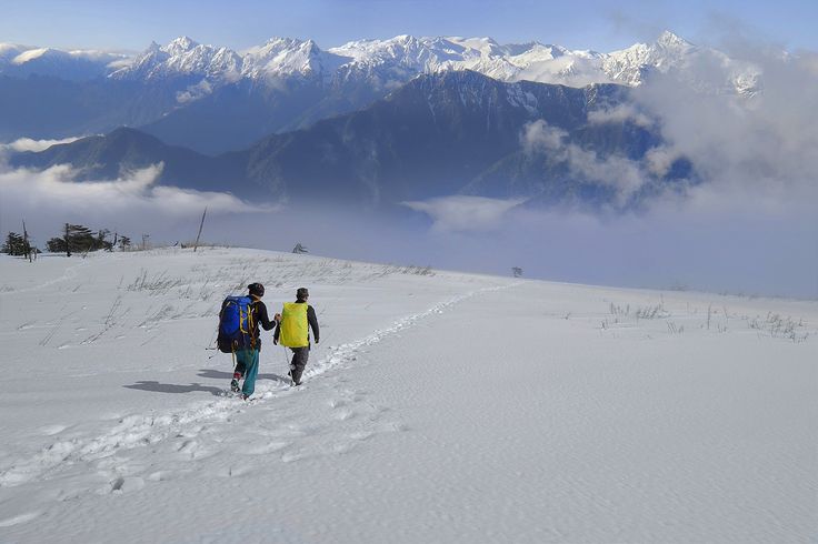
Putao is a city surrounded by snow-capped mountains that stretch toward Tibet in the northwest. It is known as the gateway to the Myanmar Himalayas.
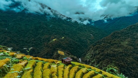
This area is famous for its rich and diverse flora. Many different kinds of orchids can be found here, including the rare black orchid. Steep fields in the valleys are used for farming. Local people grow hill rice, maize, cereal crops, cucumbers, gourds, and large marrows.
At higher elevations, from about 2,750 to 3,660 meters, the slopes are covered mostly with conifer forests. You can also find hardwoods such as oak, maple, birch, walnut, chestnut, and rhododendron. Different kinds of bamboo are also common in the area.
The weather is cold, and mist hangs over the peaceful surroundings for about six months of the year. Small streams, straw-roofed houses, and fences made of pebbles and creek stones add to the charm of the landscape.
Wildlife and Animals
Putao is home to several rare and endemic animal species, including:
· Takin (Budorcas taxicolor)
· Red Panda (Ailurus fulgens)
· Black Bear
· Black Deer
Other animals such as monkeys, wild boars, and mountain goats can also be found in the region.
In January, many kinds of butterflies can be seen, including endangered species like:
· Kaiser
· Apollo
· Bhutan Glory
· Birdwings
The best time to see butterflies, flowers, and orchids is from January to April.
Local People and Culture
Several ethnic minority groups live in the Putao region, including:
· Rawang
· Lisu
· Khamti-Shan
· Jing Paw (Kachin)
These people are known for being simple, hardworking, and hospitable. In the lower areas, they make their living by growing paddy rice and fruits.
Suspension bridges are commonly used to cross rivers in this region.
---
Travel Note
At this time, travel to Putao is not fully open for tourists. For safety and administrative reasons, we are unable to offer trips to this area at the moment. We hope to welcome visitors back when the situation allows. Please check back for future updates.
BHAMO (Bhamaw) Kachin State
Bhamo is a city in Kachin State, located about 186 km south of the capital city, Myitkyina. It sits on the banks of the Ayeyarwady River and is the nearest river port to the Chinese border.
The population is a mix of Chinese, Shan, and Kachin peoples, with Kachin communities living in the hills surrounding the town.
In the past, Bhamo was known as Sampanago and served as the capital of a now-extinct Shan kingdom called Manmaw. The ruins of the old city walls can still be seen today, about 5 km from the modern town.
The Ledo Road
Bhamo is also a town on the famous Ledo Road, which connects India, Myanmar, and China. This road is one of the most expensive ever built. More than US$137 million was spent on its construction between 1942 and 1944, under the leadership of General Joseph W. Stilwell.
---
Travel Note
At this time, travel to Bhamo is not fully open for tourists. For safety and administrative reasons, we are unable to offer trips to this area at the moment. We hope to welcome visitors back when the situation allows. Please check back for future updates.
Mt. Hkakabo Razi
Mt. Hkakabo Razi is the highest peak in Myanmar, standing at about 5,900 meters above sea level. It is located in the northernmost part of Kachin State and is part of the eastern Himalayan mountain range. The mountain was declared a protected national park in 1988.
For many years, the peak remained untouched. It was not until 1996 that a team of Japanese and Myanmar climbers made the first successful ascent.
As the highest peak in Southeast Asia, Mt. Hkakabo Razi is covered with snow all year round. It is home to hundreds of different plant and animal species. The mountain attracts not only scientists, researchers, and mountaineers but also trekkers and nature lovers.
Another interesting feature of this area is the Tarong tribe, one of the world's endangered ethnic groups. The Tarong people are known for their short stature—usually less than four feet tall—and have a shorter average lifespan.
MT. PHUNGAM
Mt. Phungam is another notable peak in the Putao region, standing at 3,485 meters above sea level. It is considered the most suitable peak for climbing among the many mountains in the area.
The mountain is usually covered with snow, except during August and September. It is located about 60 miles northwest of Putao, near the Myanmar-India border.
Because of its remote location, the region remains largely untouched. The forests and ecosystems are still in their natural state. The area is rich in biodiversity and offers great opportunities for professionals in fields like zoology, botany, forestry, and environmental conservation. It is also a perfect destination for eco-tourists and mountaineers who seek adventure beyond the usual tourist attractions.
---
Travel Note
At this time, travel to these mountain regions is not fully open for tourists. For safety and administrative reasons, we are unable to offer trips to this area at the moment. We hope to welcome visitors back when the situation allows. Please check back for future updates.