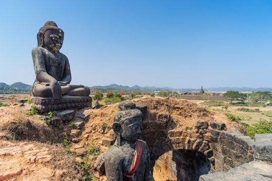
Sittwe – Rakhine State
Sittwe is the capital of Rakhine State, located in the western part of Myanmar. It became a trading seaport after the first British annexation of Myanmar. Today, the city remains an important seaport for Rakhine State.
The local economy is based mainly on sea fishing, fish farming, fish processing, and cold storage factories.
Location and Geography
The city is situated on a large island at the confluence of three rivers—the Kaladan, Laymyo, and Mayu. To the west lies the Bay of Bengal.
Sittwe also serves as the starting point for visits to the famous ancient city of Mrauk U.
Sights and Attractions
· Buddhist Museum – This modest museum is one of the best places in Myanmar to see a fine collection of Rakhine-style Buddha images.
· View Point – Also known as "The Point," this is the southernmost tip of the city, where the Bay of Bengal meets the mouth of the Kaladan River. It is a popular spot for visitors.
---
Travel Note
At this time, travel to Sittwe and the surrounding areas is not fully open for tourists. For safety and administrative reasons, we are unable to offer trips to this region at the moment. We hope to welcome visitors back when the situation allows. Please check back for future updates.
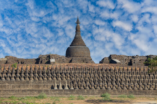
Mrauk U – Rakhine State
Mrauk U is an ancient town located in northern Rakhine State. It was founded in 1431 AD by King Min Saw Mon and served as the capital of the Rakhine Kingdom until 1785 AD.
The town is situated between the Kaladan and Lay Mro Rivers, surrounded by hills to the north and south. It can be reached by boat from Sittwe, a journey that takes about five hours.
The area is not flat—there are many high mounds with rich soil, making it easy to grow paddy rice.
Religious Monuments
Within the old city walls, you can find many pagodas, temples, and ordination halls built from well-fitted sandstone. Some of the most notable include:
· Shitthaung Pagoda (Temple of 80,000 Images) – built in 1535 AD. This is the main attraction in Mrauk U.
· Htokekanthein Temple – one of the most famous temples, its name means "Cross-Beam Ordination Hall."
· Andaw Shrine – built in 1521 AD and said to enshrine a tooth relic of the Buddha.
· Ratanabon Pagoda – another important religious site.
Wildlife and Nature
Mrauk U and its surroundings are also home to diverse wildlife. Elephants can be seen at Maru Ridge, northwest of Mrauk U. Many other wild animals roam the countryside, and about 300 species of birds can be found in the hills.
---
Travel Note
At this time, travel to Mrauk U is not fully open for tourists. For safety and administrative reasons, we are unable to offer trips to this area at the moment. We hope to welcome visitors back when the situation allows. Please check back for future updates.
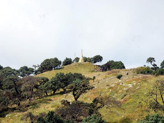
Mt. Victoria (Nat Ma Taung)
Mt. Victoria, also known as Nat Ma Taung, is the third highest mountain in Myanmar. It stands at about 10,200 feet (3,100 meters) above sea level. The mountain is located in Chin State, within the townships of Kanpetlet, Mindat, and Matupi. It is part of the Himalayan mountain range and covers an area of about 722 square kilometers.
Forests and Wildlife
The region is home to a variety of forest types, including evergreen forest, deciduous forest, pine forest, and hill savanna. Over 200 species of birds have been recorded here.
One of the most special birds is the White-browed Nuthatch (Sitta victoriae) , which is endemic to Myanmar and can only be found in this area.
The mountain is also home to mammals such as:
· Leopards
· Wild boars
· Wild cats
· Gaurs (wild cattle)
· Gibbons
Reptiles and butterflies are also abundant in the area.
Flowers and Scenery
At the summit, you can find rare flowers. The Rhododendron arboreum—with white, red, and yellow blooms—is especially famous and is considered a symbol of both Mt. Victoria and Chin State.
Cultural Heritage
A trip to Mt. Victoria offers not only natural beauty but also a chance to observe the traditional culture and way of life of the Chin people. Many of the elderly women in the area have thick tattoos on their faces, a traditional practice that is slowly disappearing.
---
Travel Note
At this time, travel to Mt. Victoria and the surrounding areas is not fully open for tourists. For safety and administrative reasons, we are unable to offer trips to this region at the moment. We hope to welcome visitors back when the situation allows. Please check back for future updates.
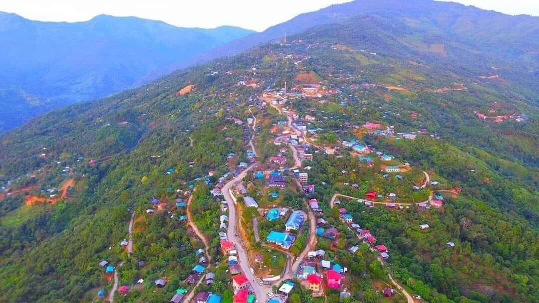
Kanpetlet – Chin State
Kanpetlet is a small town in southern Chin State, with a population of only a few thousand people. It sits at an elevation of about 1,370 meters above sea level. The town is about 80 kilometers from Mindat and is one of the two main gateways for climbing Mt. Victoria.
The ascent from Kanpetlet is much easier compared to the route from Mindat. Visitors can drive up to about 2,740 meters on Mt. Victoria, where the walking trail to the summit begins. From there, a moderate trek of about one hour will take you to the peak.
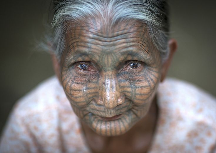
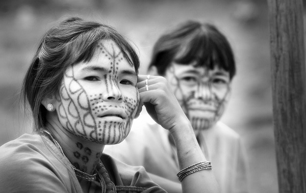
The Tattooed Women of Chin State
Myanmar is home to many unique traditions, and one of the most fascinating is the custom of facial tattooing among the women of certain tribes. This practice was once common among the Munn and Dai tribes, who live in the mountains near Mt. Victoria in western Myanmar.
Why Did They Tattoo Their Faces?
There are different stories behind this tradition:
· Beauty and Attractiveness: Some believe that tattoos were seen as a sign of beauty. The more tattoos a woman had, the more beautiful she was considered.
· Protection from Kings: Another story says that in the 11th century, women from these tribes were so beautiful that they often caught the attention of kings and their soldiers. To avoid being taken away, the women tattooed their faces to make themselves less appealing.
Over time, facial tattoos became a symbol of beauty, endurance, and pride. It was also said that a woman without tattoos would have difficulty finding a husband.
The Tattooing Process
Girls between the ages of 11 and 15 would begin the tattooing process. It was painful, and often their faces would swell afterward, so they would not go out during the healing period.
The needles were made from pine wood, and the ink was made from the sap of special trees. In some cases, resin and buffalo kidney were mixed with the ink to make it last longer and resist fading.
Most young girls were afraid of the process, but they considered it necessary.
Designs and Patterns
There were no set standards for the designs. Each woman chose patterns based on personal preference. Some had only a few marks, while others had their entire faces covered.
The Tradition Today
This custom is no longer practiced. It was banned by the government, and those who continued could be punished. Today, only elderly women still have tattoos on their faces. Younger generations have moved to larger cities and no longer follow this tradition.
Visiting the Tribes Today
If you travel to the mountains near Mt. Victoria, you may still meet elderly tribal women with tattooed faces. They are known for being open, friendly, and welcoming to visitors. Meeting them offers a rare glimpse into a disappearing part of Myanmar's cultural heritage.
---
Travel Note
At this time, travel to Chin State and Mt. Victoria is not fully open for tourists. For safety and administrative reasons, we are unable to offer trips to this region at the moment. We hope to welcome visitors back when the situation allows. Please check back for future updates.
Kalay (Sagaing Region)
Kalay is a small town in Sagaing Region, located east of the Chin mountain ranges. It sits near the border between Sagaing Region and Chin State (northern Chin State) and is about 132.8 kilometers from the Myanmar-India border town of Tamu.
During World War II, Tamu was part of the famous Imphal Operation in 1944.
Because of its strategic location, Kalay serves as a gateway to northern Chin State and is also an important town on the Myanmar-India border trading route.
Until early 2004, the town relied heavily on air and river transport. However, in mid-2004, a new motor road—the Monywa–Yagyi–Kalaywa road—was fully opened. This 184-kilometer road has 174 large and small bridges and has greatly increased Kalay's importance as a trading hub.
Tamu (Sagaing Region)
Tamu is a small border town on the Myanmar-India border. It is located in the Kabaw Valley of Sagaing Region and is connected to Moreh, India, by a bridge over the Mathuyar Creek.
The town began to grow steadily after a bilateral trade agreement was signed between Myanmar and India in 1994. A decade later, the opening of the Monywa–Yagyi–Kalaywa motor road significantly shortened travel time from Tamu to Mandalay, further boosting border trade.
Today, Tamu is not only a hub for trade between Myanmar and India but also handles goods from Thailand and China heading to India, and vice versa.